

Geographic Information System

Descripción de Geographic Information System
The app is a complete free handbook of Geographic Information System- GIS which covers important topics, notes, materials & news on the course. Download the App as a reference material & digital book for Civil & other engineering programs & degree courses.
This useful App lists 100 topics with detailed notes, diagrams, equations, formulas & course material, the topics are listed in 5 chapters. The app is must have for all the engineering science students & professionals.
The app provides quick revision and reference to the important topics like a detailed flash card notes, it makes it easy & useful for the student or a professional to cover the course syllabus quickly just before an exams or job interviews.
Also get the hottest international engineering & technology news on your app powered by Google news feeds. We have customised it so that you get regular updates on the subject from international/national colleges, universities, research, industry, applications, engineering, tech, articles & innovation.
This is the best application to remain updated on your fav. subject.
Use this useful engineering app as your education tool, utility, tutorial, book, a reference guide for syllabus and explore study course material, aptitude tests & project work.
Track your learning, set reminders, edit, add favourite topics, share the topics on social media.
Some of the topics Covered in this application are:
1. INTRODUCTION OF GIS
2. GIS to Geocomputation
3. Technological Facilitation
4. BASIC FUNCTIONALITY OF GIS
5. A SYSTEM DEFINITION OF GIS
6. GIS Science and the Rise of Geo-Information Engineering
7. GIS SCIENCE TO FOLLOW
8. ISSUES OF GISCIENCE AS SELECTIVE GROUPING OF ASPECTS
9. INTRODUCTION OF CARTOGRAPHY
10. GEOINFORMATION TECHNOLOGY AND CARTOGRAPHY
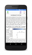
11. COORDINATE SYSTEM
12. GLOBAL SYSTEMS
13. PROJECTION BASICS FOR GIS PROFESSIONALS
14. MAP SCALE
15. MAP PROJECTION
16. GEOMETRIC TRANSFORMATION
17. VECTOR AND RASTER DATA
18. SAPATIAL PHENOMENON OF GIS
19. SPATIAL DATA FUNCTION
20. DATA COLLECTION TECHNOLOGIES
21. REMOTE SENSING
22. GROUND SURVEY
23. The Role and Nature of Environmental Models
24. CONTEXT OF ENVIRONMENTAL MODELLING
25. A SUMMARY OF MODEL DEVELOPMENT
26. APPLYING MODELS
27. MODELLING LANDSLIDES
28. MODELLING TOPOGRAPHY
29. TYPOLOGY OF MODELS
30. APPROACHES TO MODELLING
31. REPRESENTATION AND COMPUTATION OF GEOGRAPHIC DYNAMICS
32. TEMPORAL MODELLING
33. TEMPORAL GIS
34. DATABASE CONCEPTS
35. DATABASE DESIGN
36. DATA INPUT TECHNIQUES
37. DATA ENCODING
38. GLOBAL POSITIONING SYSTEM(GPS)
39. COMPARISON OF ENCODING AND DECODING
40. MAP LAYOUTS
41. MAP LAYOUTS ELEMENTS
42. COMPLETING MAPS AND SEQUENCES
43. SEQUENCING TECHNOLOGIES
44. MAPPING TECHNOLOGY
45. EVALUATING MODELS
46. MAP ALGEBRA
47. MAP ELGEBRA INPUT TYPES
48. OVERLAY ANALYSIS
49. VECRTOR AND RASTER OVERLAY
50. TARAIN MODELLING
51. SPATIAL INTERPOLATION
52. TRANSFER FUNCTION
53. GIS & ARTIFICIAL NEURAL NETWORKS
54. NETWORKS
55. GIS AND NETWORK ANALYSIS
56. WATER RESOURCE APPLICATIONS OF GIS
57. HYDROLOGIC MODELLING
58. GIS AND SOCIETY
59. GIS AND TRANSPORTATION
60. GIS BASED ASSESSMENT OF GEOTECHNICAL CHARACTIRISTICS
61. GEOTECHNICAL STRUCTURES
62. SPATAIL DATA GENERILAZTION IN GIS
63. WEB MAPPING
64. IMPORTANCE OF WEB BASED DESIGN
65. ENVIRONMENTAL IMPACT ANALYSIS
66. MAP SERVICE
67. ESTABLISHMENT AND DEVELOPMENT OF EFA MONITORING SYSTEMS
68. GIS IN UTILITY MANAGEMENT
69. THEMTIC MAPPING
70. Restructured-Accelerated Power Development and Reforms Programmed
71. GIS IN UTILITY MANAGEMENT
72. THEMTIC MAPPING
73. Restructured-Accelerated Power Development and Reforms Programmed
74. PHOTOGRAMMETRY
75. MOBILE MAPPING
Each topic is complete with diagrams, equations and other forms of graphical representations for better learning and quick understanding.
GIS is part of Civil & other engineering education courses and technology degree programs of various universities.
La aplicación es gratuita un manual completo de Información Geográfica SIG System- que abarca temas importantes, notas, materiales y noticias sobre el curso. Descargar la aplicación como material de referencia y libros digitales para programas civiles y otra de ingeniería y titulaciones.
Esta útil aplicación enumera 100 temas con notas detalladas, diagramas, ecuaciones, fórmulas y material del curso, los temas se enumeran en 5 capítulos. La aplicación se debe tener para todos los estudiantes de ciencias de la ingeniería y profesionales.
La aplicación proporciona la revisión rápida y la referencia a los temas importantes como unas detalladas notas de tarjetas flash, que hace que sea fácil y útil para el estudiante o un profesional para cubrir el programa del curso rápidamente justo antes de un examen o una entrevista de trabajo.
También tendrá la más caliente de ingeniería y tecnología de las noticias internacionales en su aplicación impulsado por las noticias de Google alimenta. Hemos personalizado de forma que se obtiene actualizaciones periódicas sobre el tema a partir internacionales / nacionales universidades, la investigación, la industria, aplicaciones, ingeniería, tecnología, artículos y la innovación.
Esta es la mejor aplicación para mantenerse actualizado en su favorito. tema.
Utilice esta aplicación de ingeniería de utilidad como herramienta de educación, de servicios públicos, tutorial, libro, una guía de referencia para el programa de estudios y explorar el material del curso del estudio, las pruebas de aptitud y el trabajo del proyecto.
El seguimiento de su aprendizaje, establecer recordatorios, editar, añadir temas favoritos, compartir los temas en los medios sociales.
Algunos de los temas tratados en esta aplicación son:
1. INTRODUCCIÓN DE SIG
2. SIG a Geocomputación
3. Facilitación Tecnológico
4. Funcionalidad básica de SIG
5. UN SISTEMA DE DEFINICIÓN DE SIG
6. SIG Ciencia y la subida de Geo-Ingeniería de la Información
7. SIG CIENCIA A SEGUIR
8. ASPECTOS DE Ciencia IG de agrupamiento de la SELECTIVA DE ASPECTOS
9. Introducción de la cartografía
10. TECNOLOGÍA geoinformación y CARTOGRAFÍA
11. Sistema de Coordenadas
12. SISTEMAS GLOBALES
13. FUNDAMENTOS DE PROYECCIÓN PARA PROFESIONALES GIS
ESCALA 14. MAPA
PROYECCIÓN 15. MAPA
16. transformación geométrica
17. VECTOR Y DATOS DE LA TRAMA
18. FENÓMENO DE sapatial SIG
19. FUNCIÓN DE DATOS ESPACIALES
20. TECNOLOGÍAS DE RECOGIDA DE DATOS
21. TELEDETECCION
22. ENCUESTA DE TIERRA
23. El papel y la naturaleza de los modelos ambientales
24. CONTEXTO DE Environmental Modelling
25. RESUMEN DE DESARROLLO DEL MODELO
26. APLICACIÓN DE MODELOS
27. DERRUMBAMIENTOS MODELISMO
TOPOGRAFÍA 28. MODELADO
29. TIPOLOGÍA DE MODELOS
30. CRITERIOS DE MODELAJE
31. REPRESENTACIÓN Y CÁLCULO DE LA DINÁMICA GEOGRÁFICA
32. MODELADO TEMPORAL
33. SIG TEMPORAL
34. CONCEPTOS DE BASE DE DATOS
35. DISEÑO DE BASE DE DATOS
36. TÉCNICAS DE DATOS DE ENTRADA
37. CODIFICACIÓN DE DATOS
38. SISTEMA DE POSICIONAMIENTO GLOBAL (GPS)
39. Comparación de la codificación y decodificación
40. ESQUEMAS MAPA
41. MAPA diseños ELEMENTOS
42. TERMINACIÓN DE MAPAS Y SECUENCIAS
43. Las tecnologías de secuenciación
TECNOLOGÍA 44. MAPEO
45. EVALUACIÓN DE MODELOS
46. Álgebra de mapas
47. Los tipos de entrada MAPA ELGEBRA
ANÁLISIS 48. PLANTILLA
49. VECRTOR Y PLANTILLA DE LA TRAMA
50. MODELADO Tarain
51. interpolación espacial
FUNCIÓN 52. TRANSFERENCIA
53. SIG y redes neuronales artificiales
54. REDES
55. SIG y análisis de redes
56. RECURSOS DE AGUA DE APLICACIONES SIG
57. MODELACIÓN HIDROLÓGICA
58. SIG Y SOCIEDAD
59. SIG Y TRANSPORTE
60. SIG EN BASE DE EVALUACIÓN CHARACTIRISTICS GEOTÉCNICOS
61. ESTRUCTURAS GEOTÉCNICOS
62. SPATAIL DATOS EN GENERILAZTION SIG
63. MAPEO WEB
64. importancia del diseño BASADA EN WEB
ANÁLISIS 65. IMPACTO AMBIENTAL
66. SERVICIO DE MAPA
67. CREACIÓN Y DESARROLLO DE SISTEMAS Seguimiento de la EPT
68. SIG en la gestión UTILIDAD
69. MAPEO THEMTIC
70.-reestructurado el desarrollo acelerado de alimentación y reformas planeadas
71. SIG en la gestión UTILIDAD
72. MAPEO THEMTIC
73.-reestructurado el desarrollo acelerado de alimentación y reformas planeadas
74. FOTOGRAMETRÍA
75. cartografía móvil
Cada tema se completa con diagramas, ecuaciones y otras formas de representaciones gráficas para un mejor aprendizaje y la comprensión rápida.
GIS es parte de civil y otros cursos de educación de ingeniería y programas de grado de tecnología de varias universidades.


